Atlantic 'storm factory' brews up more wet winter weather
Release Date 30 January 2014

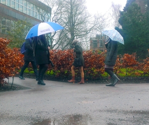
With Met Office figures showing parts of Britain have had the wettest January on record, Reading weather experts say an Atlantic ‘storm factory' is to blame - and there could be more to come.
National records of rainfall began in 1910, but the University of Reading has kept continuous records of rainfall statistics from 1908.
According to observations at the University of Reading's weather station during January, a total of 136.5 mm of rain fell during the month, making it the wettest January at the University since before 1908. Previously, the wettest January had been in 1995 when 128.7 mm of rain fell. The average rainfall during January is just 60.5 mm.
According to Dr Roger Brugge, of the University's Department of Meteorology, despite all the rain - with more forecast in coming days - there has paradoxically also been more sunshine than average.
Dr Brugge said: "January is also set to be a warmer-than-average month - the average temperature will be about 1.2 degC above average at 6 °C. There has been much less air frost than normal, on just 5 days so far, although at grass tip level we have recorded 20 days with a ground frost.
"With all the cloud, wind and rain, people will be surprised to find that January has also been slightly sunnier than average with Reading having twice the sunshine it recorded in January 2013.
"Following on from the wet end to December, Reading had now received 242.5 mm of rain so far this winter. With four weeks of the meteorological winter still to run it is already the wettest winter since 2000/2001, although our wettest winters of the past century were those of 1994/1995 with 283.3 mm, 1914/1915 with 327.9 mm and 1989/1990 with 344.6 mm. Each of these winters also had problems with flooding along Reading's rivers."
So what's been behind all this wet weather?
Dr Andrew Barrett, a storm expert at the University of Reading, said: "The conditions have been exactly right to bring wet weather across Britain. There's effectively a storm factory over the Atlantic, caused by cold polar air pressing up against warm, tropical air, causing weather systems to form. These have then been steered across Britain by a strong jet stream, bringing our weather from the west and south-west.
"This has brought a steady succession of weather systems, which have drenched southern Britain in a continuous stream of wet and stormy weather. This almost non-stop rain has filled up groundwater stores, saturated the soil, and filled rivers. After that, there's nowhere for the water to go but to cause floods."
"It will be scant consolation to those whose homes have been flooded, but January has also actually been sunnier than we'd expect - twice as sunny as last year - and much warmer than average.
"The next week to 10 days shows no sign of a change to the wet and warm conditions. If the current conditions continue, this will almost certainly be the wettest winter on record. But this could change quickly, and predicting the weather much more than a week ahead is very difficult. A move to more northerly winds could bring ice and snow. Winter could still have an icy sting in its tail."
